
Environment
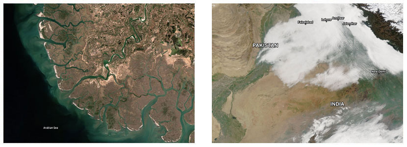
Space based technologies such as remote sensing data have enhanced human understanding of environment. Remote sensing data provides unique capability to assess environmental impacts. Important areas of application are;
- Environmental monitoring (air, sea and land)
- Water quality monitoring
- Fog and aerosol monitoring
- Air pollution
- Dispersion modeling
- Monitor coastal zone ecosystem
- Marine pollution
- Land degradation & erosion modeling
Satellite Data Receiving and Processing Centre
Satellite data from Geostationary and Polar orbiting environmental satellites is acquired for environmental monitoring and research.
Geostationary Satellites
- MT SAT
- GOMS
- Meteosat
- FENGYUN-2C
Polar Orbiting Satellites
- NOAA
- AQUA / TERRA
- Envi
- Landsat
Data Applications
- Aerosol & Gaseous Components (AOD, BC, Hg, O3, SOx, NOx, CO2)
- Atmospheric Profiles (Tropospheric & Stratospheric Ozone)
- Water Quality (DO, Chlorophyll, Phosphorus, Turbidity)
- Glacier & Climate Change (Snow cover, hazards)
- Marine & Coastal Studies, Droughts
- Biomass Assessment (Surface biomass)
Environmental Laboratories
Ambient Air Monitoring Mobile Laboratory
- CO2, CO
- SOx, NOx
- Ground Level O3
- Black Carbon (BC)
- Gaseous Mercury
- Particulate Matter (TSP, PM10, PM5)
Environmental Chemistry Laboratory
- ICP-MS
- GC-MS
- Ion Chromatograph
- CHNS-O Analyzer
- COD / BOD Analyzers
- UV-Vis Spectrometer
- Asbestos Microscope
- Microwave Digestion Oven
- Fume Hood / Biosafety Cabinet
Mathematical Modeling Center
Mathematical model simulations are applied in R&D and commercial projects for dispersion modeling and long-range transport analysis.
- AERMOD Atmospheric Dispersion Model
- CALPUFF Atmospheric Dispersion Model
- HYSPLITT Model
Microgravity Experiments Facility
Microgravity research enables discoveries by eliminating buoyancy, convection, and sedimentation effects.
- 2-D Clinostats: Single rotation axis
- 3-D Clinostats: Dual rotation axes
SUPARCO conducts plant research using both 2-D and 3-D clinostat facilities. These are available for researchers and students.